Rapha Travel


Rapha Travel
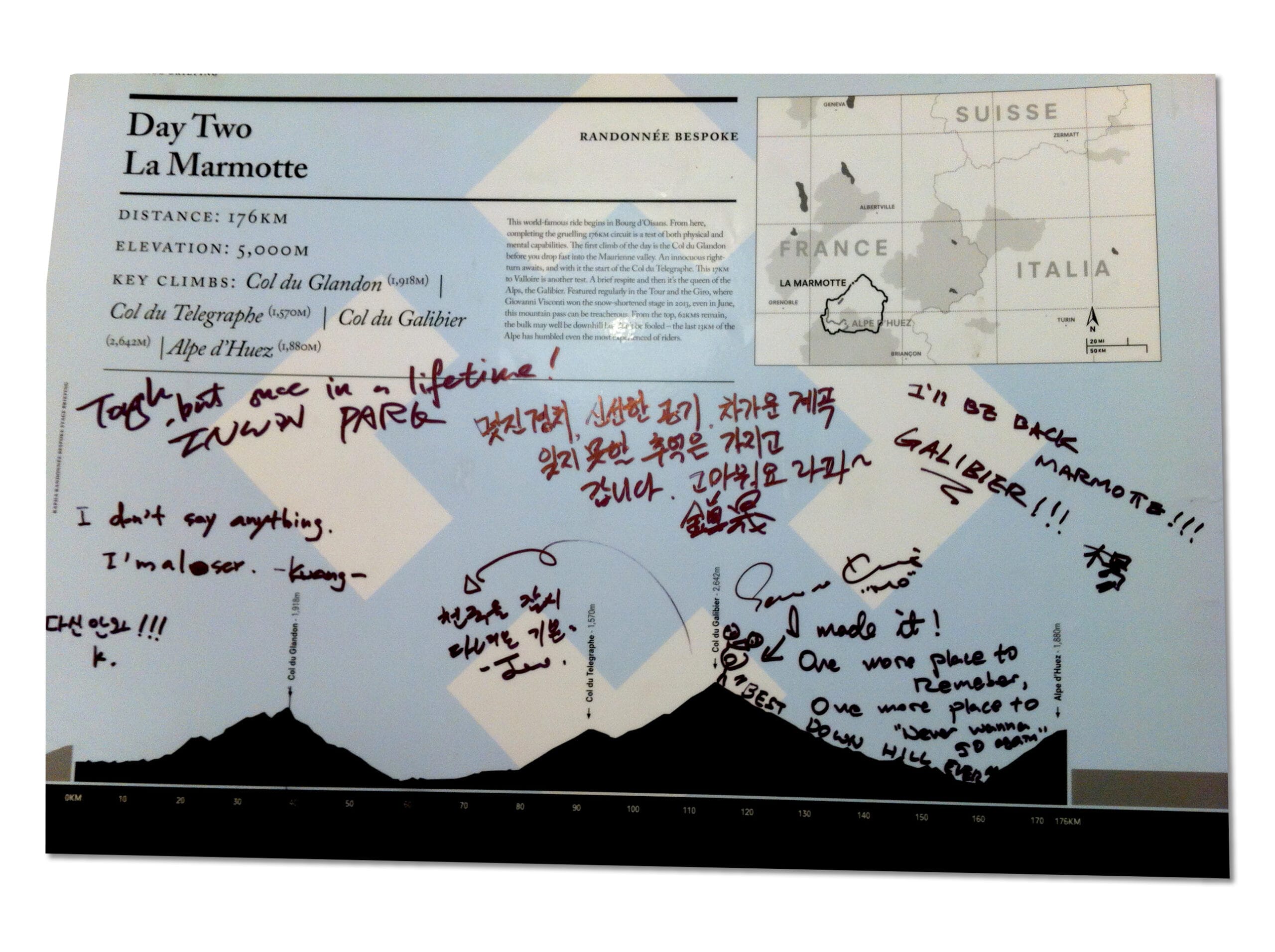
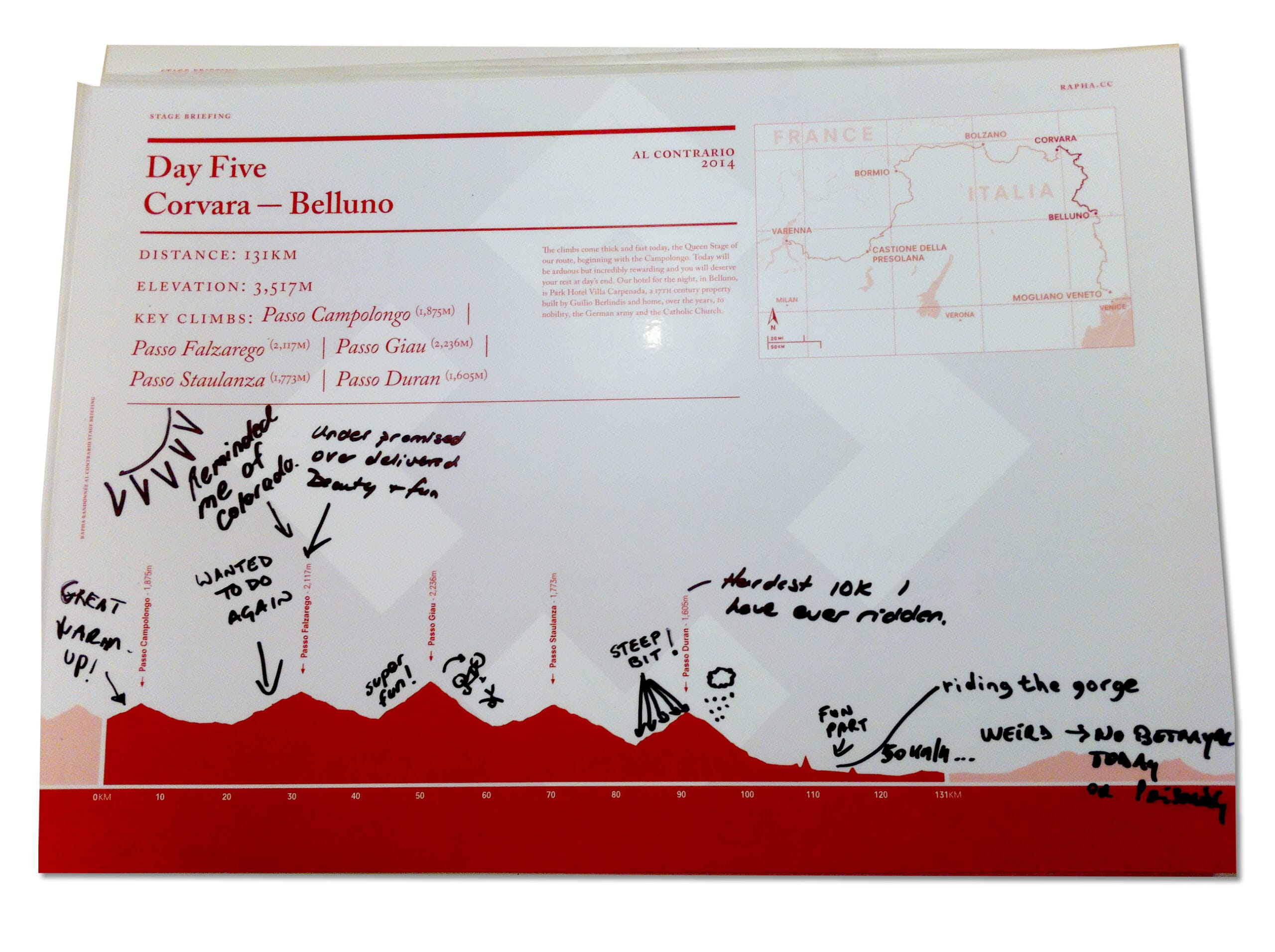
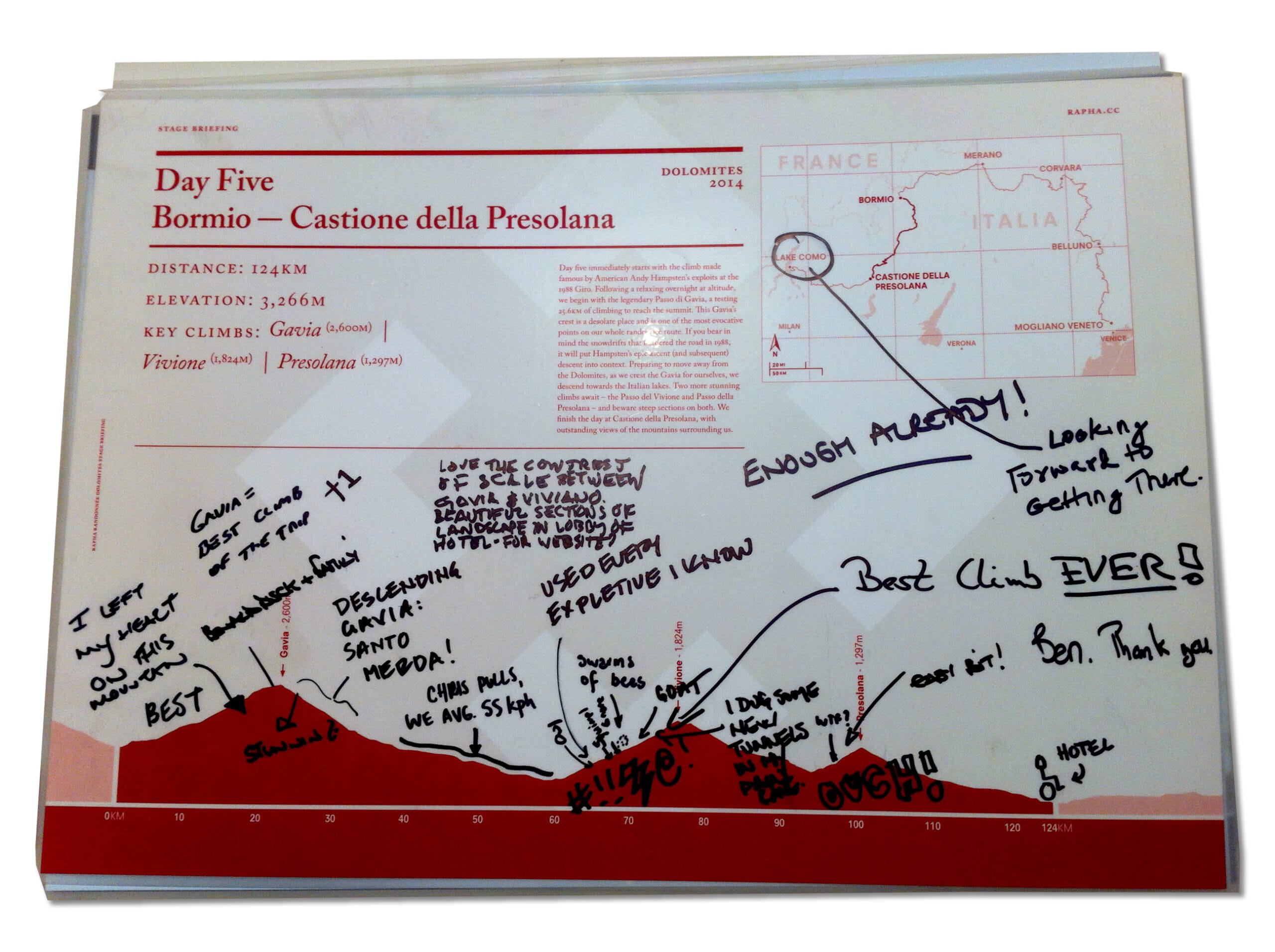
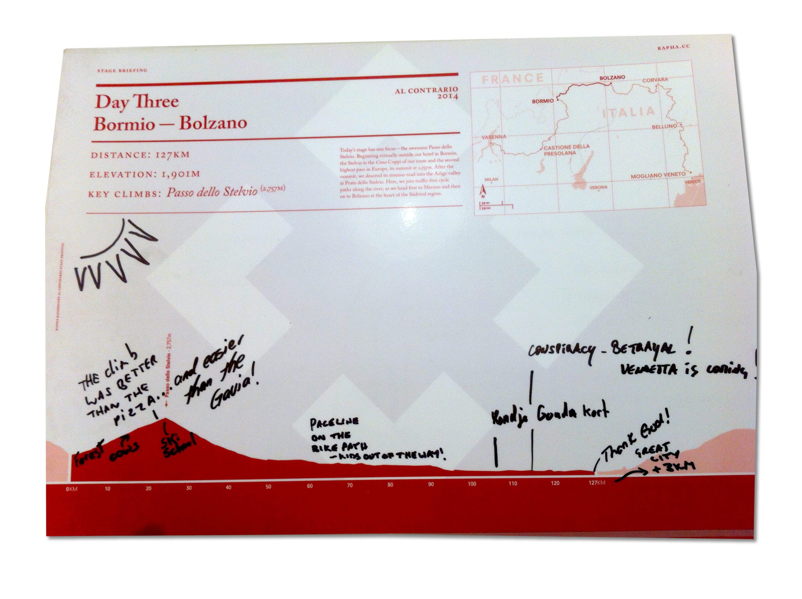
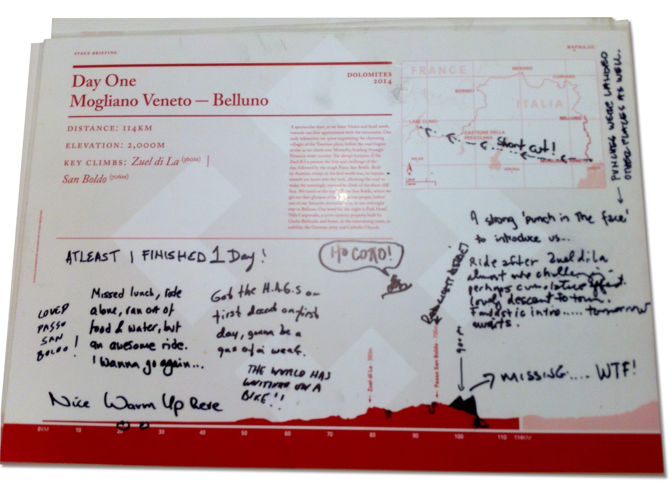
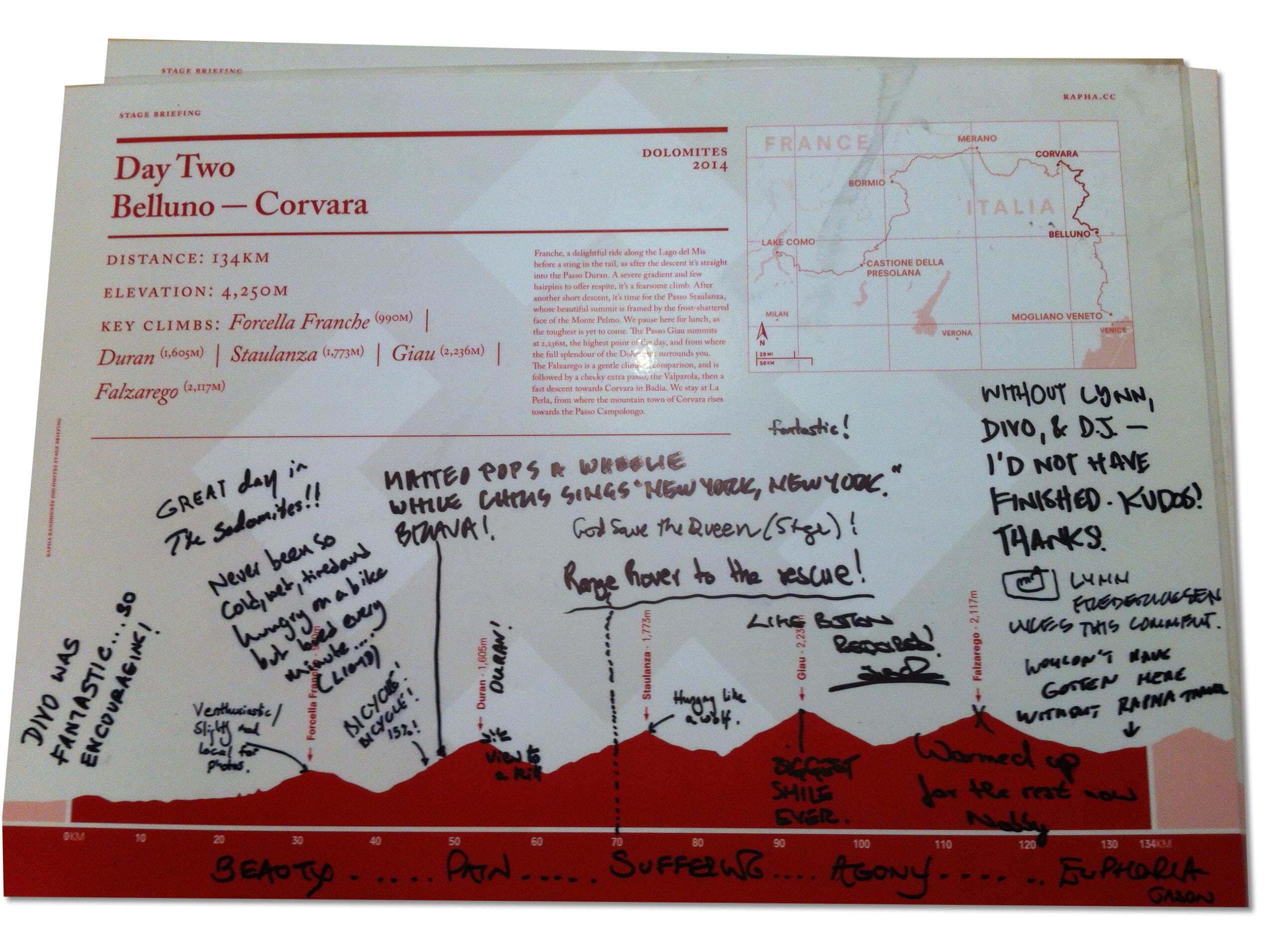
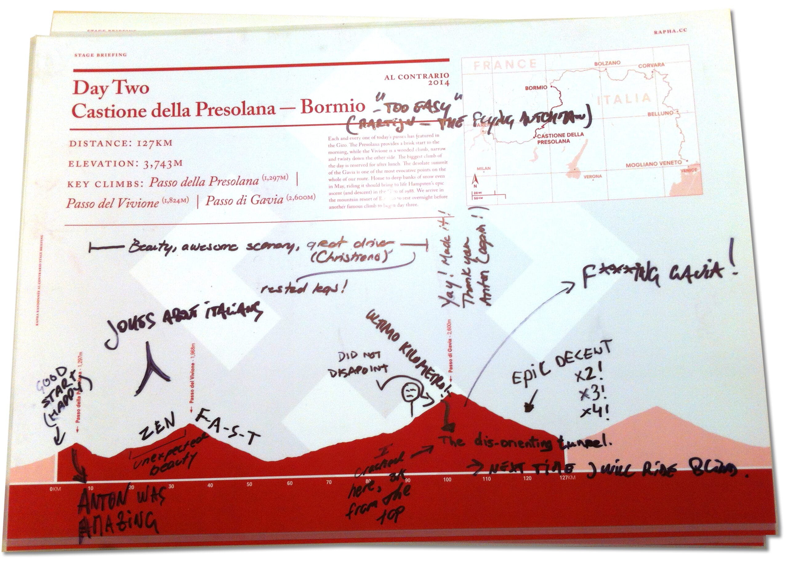
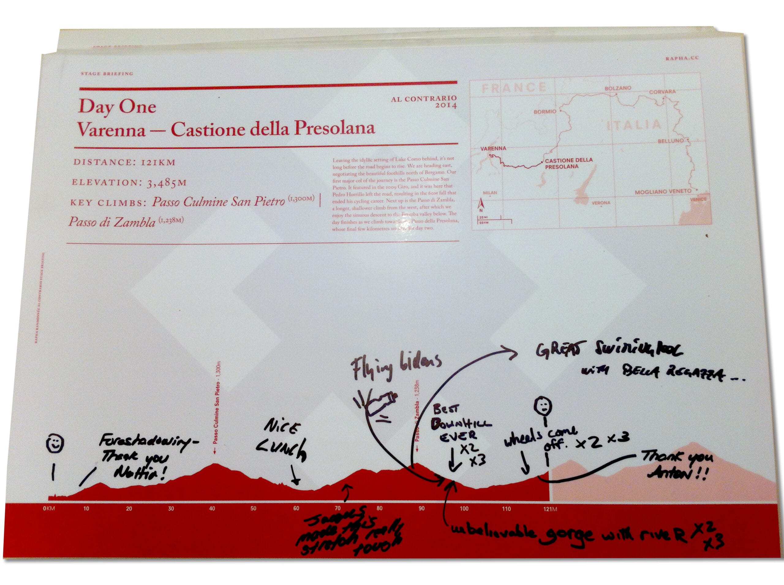
Rapha Travel was, for a few years, the most excellent cycling trips. Crafted adventures, lead by some excellent riders (and Brad heading the (united) division) and I was delighted to be tested myself with maps, ride profiles (elevations) and rider information (booklets, cue cards, top tube guides, postcards etc). Indulgent perhaps but sometimes when things are taken to extremes even epic suffering can be luxurious.
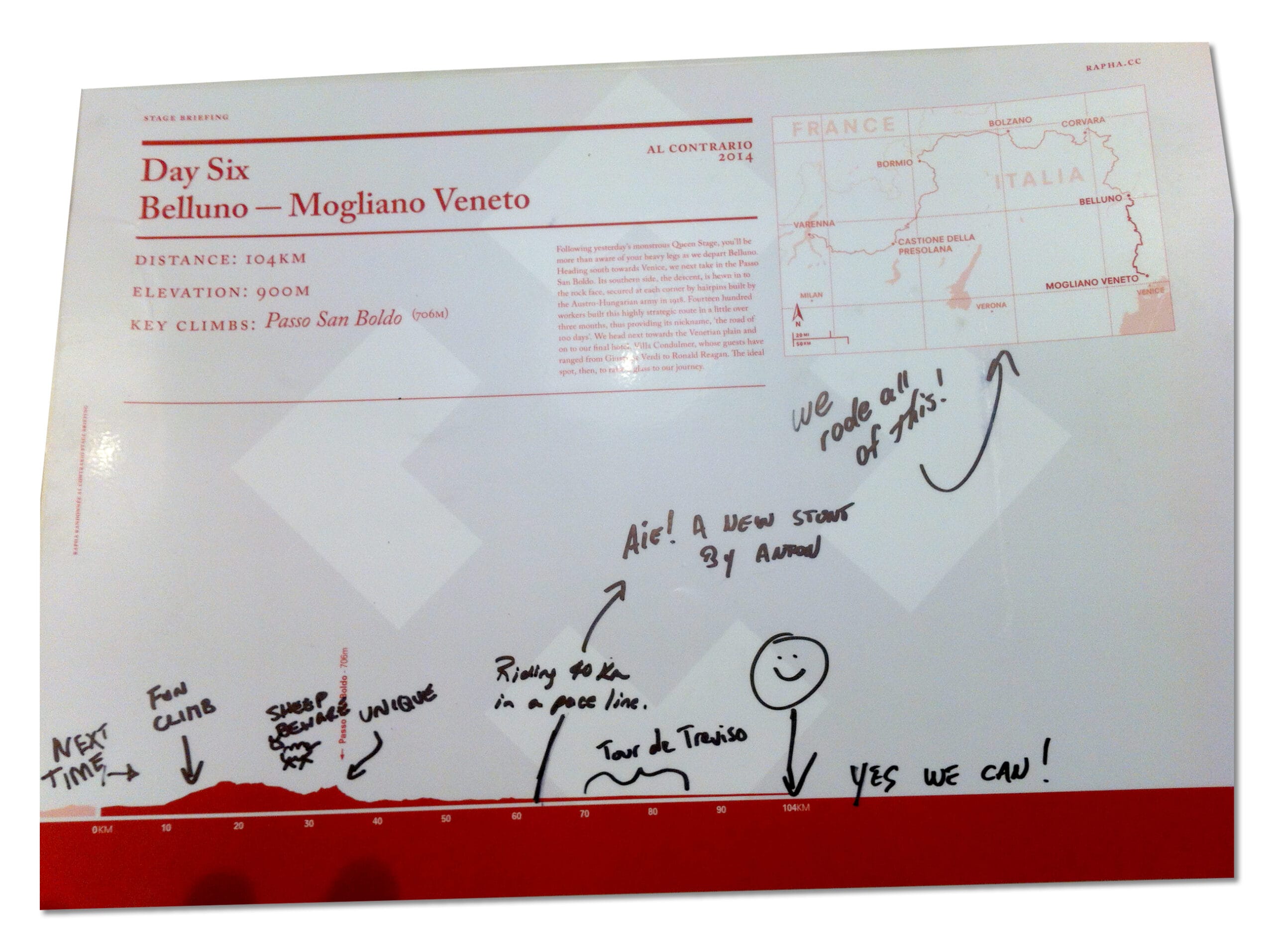
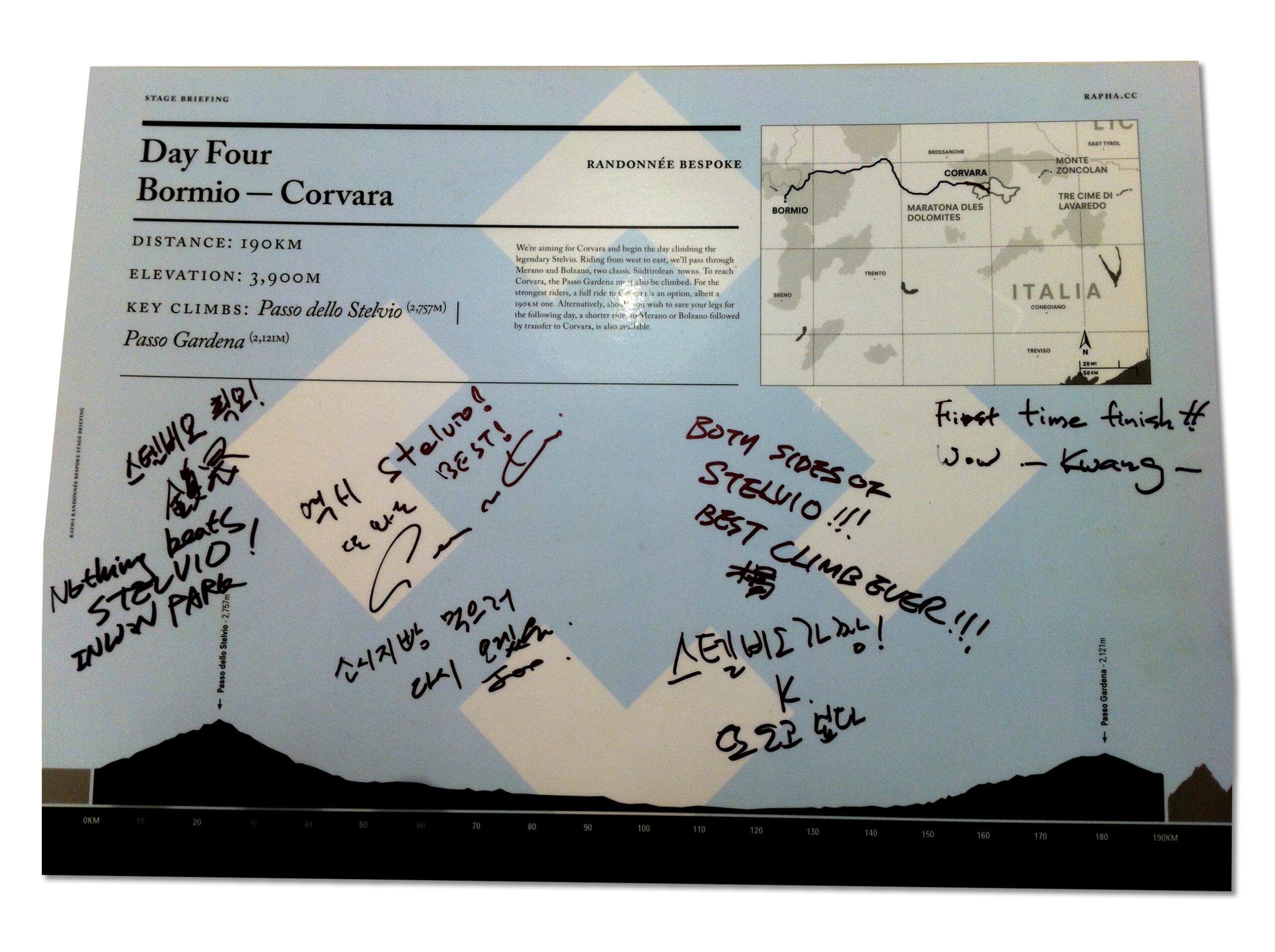
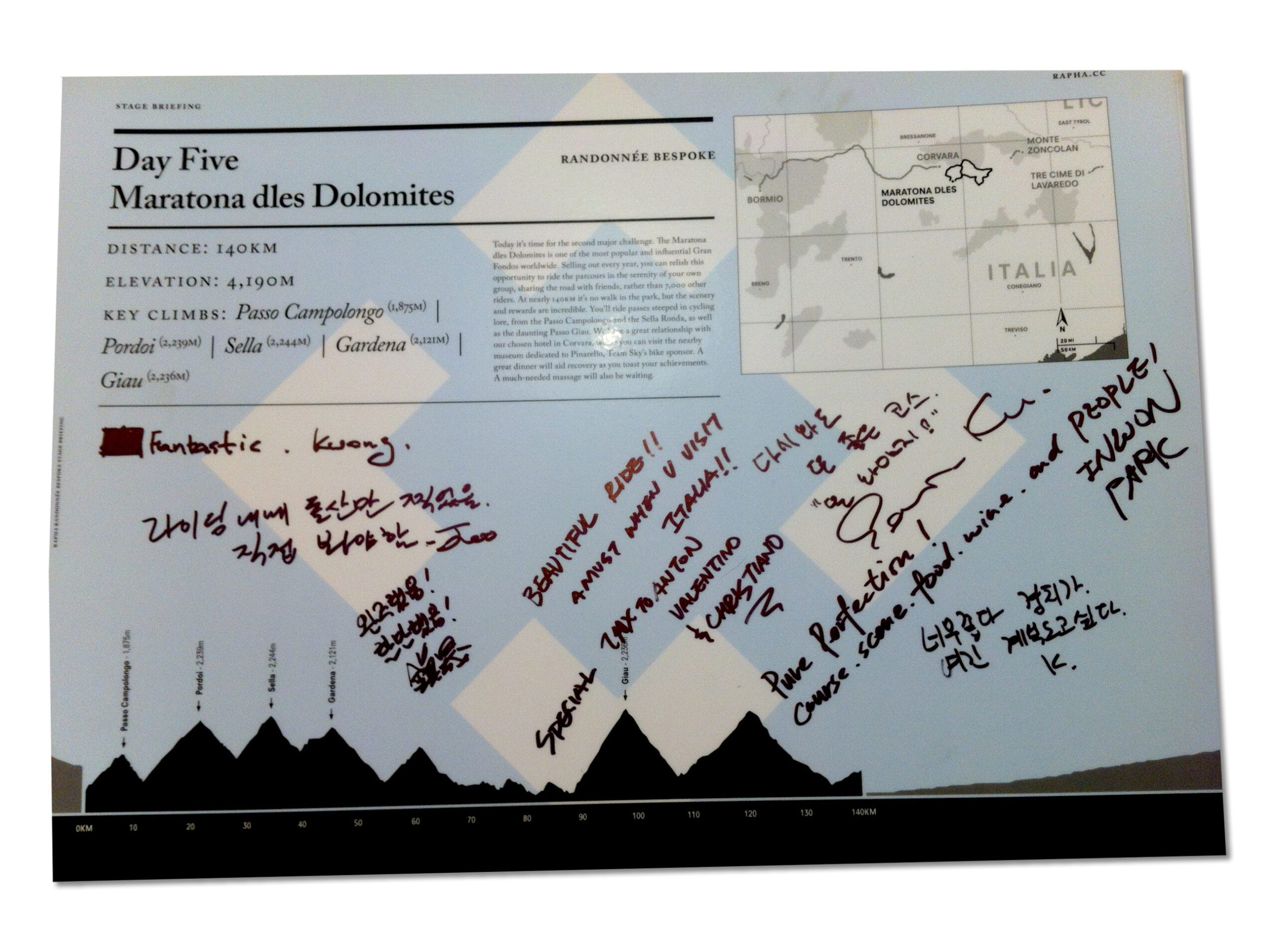
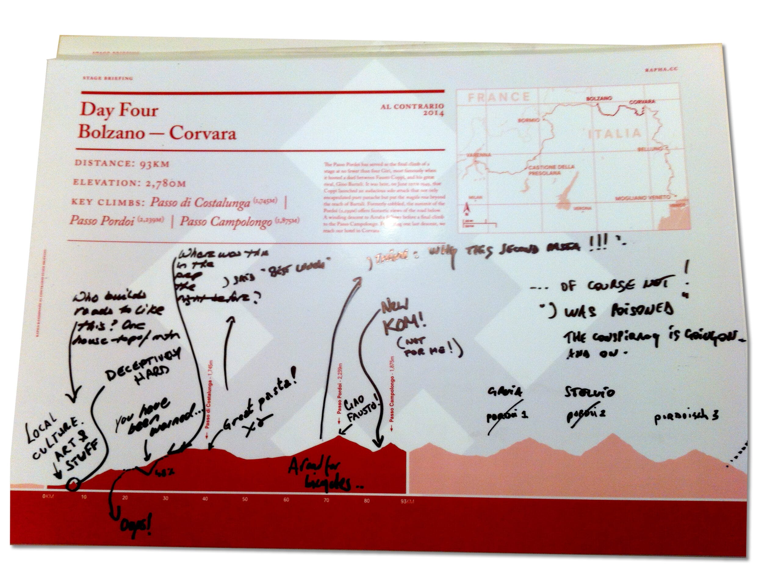
Can’t even begin to explain the tech. behind all this. This was way before the GPX/GPS advances we have now. Early days were spent with online maps and elevations and screengrabs and cutting and sticking and swearing – handcrafted. Then I moved on. A chance conversation with a very smart friend (thank you Andy) had him build me a GPX to SVG elevation prog. Crazy clever. Still much to be done but it was a game-changer (life-saver). Just left me with the intricate Adobe Illustrator work to ensure hills weren’t concave slopes and then precise and careful typography to make these maps as good as they needed to be. The best thing? Getting the big A3 posters back from the trips to see they’d be scrawled over with rider notes and platitudes. Fucking ace to see my work not just used but really abused and appreciated. I like to think I really added to those peoples' adventures (although they also pointed out some climbs I'd messed up on! Fair enough but, as I said, it was fully manual back then and I did the best I could. I do make mistakes. But I also own up to them.)


